
.svg)
.svg)
Surveyors increasingly rely on point cloud AI solutions to transform raw scan data into accurate, actionable CAD designs. Nest3D has emerged as a leading solution in this space, delivering advanced point cloud processing and point cloud software combining AI and human monitoring and adjustment to ensure high accuracy. This enables professionals to rapidly convert point cloud data into clean, DWG-ready CAD drawings, reducing drafting time while maintaining exceptional accuracy.
How Nest3D Transforms Point Cloud Drafting?
Nest3D integrates point cloud tools directly into common CAD platforms such as AutoCAD, BricsCAD, and ZWCAD. This process ensures a smooth transition for surveyors. This seamless integration maximises efficiency and keeps existing drafting workflows intact. Key features include:
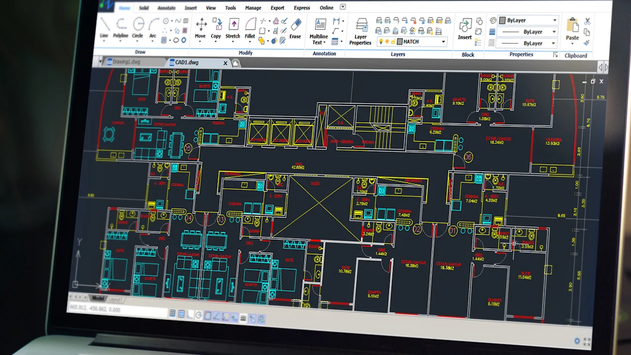
• Automatic Linework Extraction: AI-powered tools support E57 and FLS scans to produce CAD-ready drawings instantly. Automated extraction cuts hours off drafting time, compared to manual extraction.
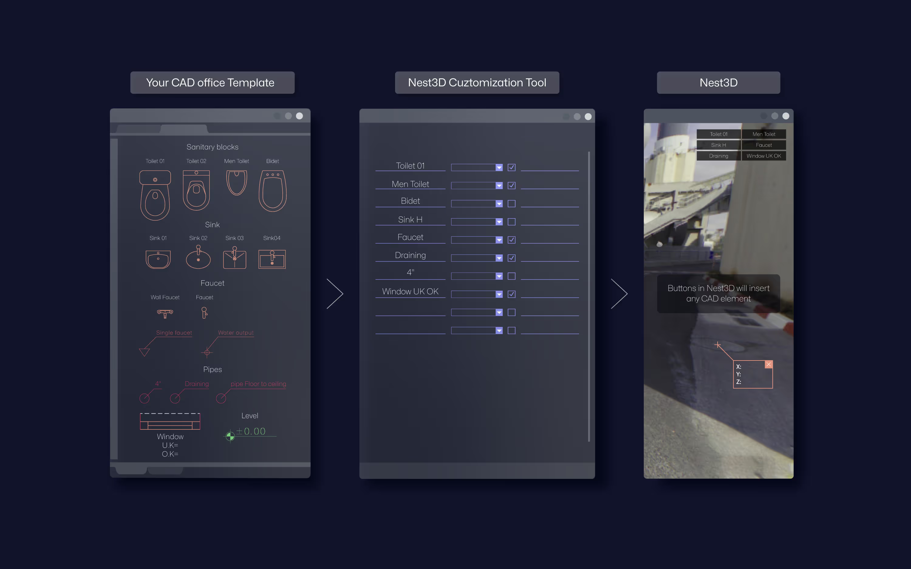
• Template-Driven Consistency: Nest3D uses customized DWG templates, layers, linetypes, and blocks, ensuring every drawing meets organisational CAD and surveying office standards.
• Complete Scan-to-CAD Workflow: From field capture to final CAD drawings, Nest3D manages the entire process. Whether using terrestrial or mobile SLAM scanners, point cloud data is converted efficiently into precise DWG and BIM files.
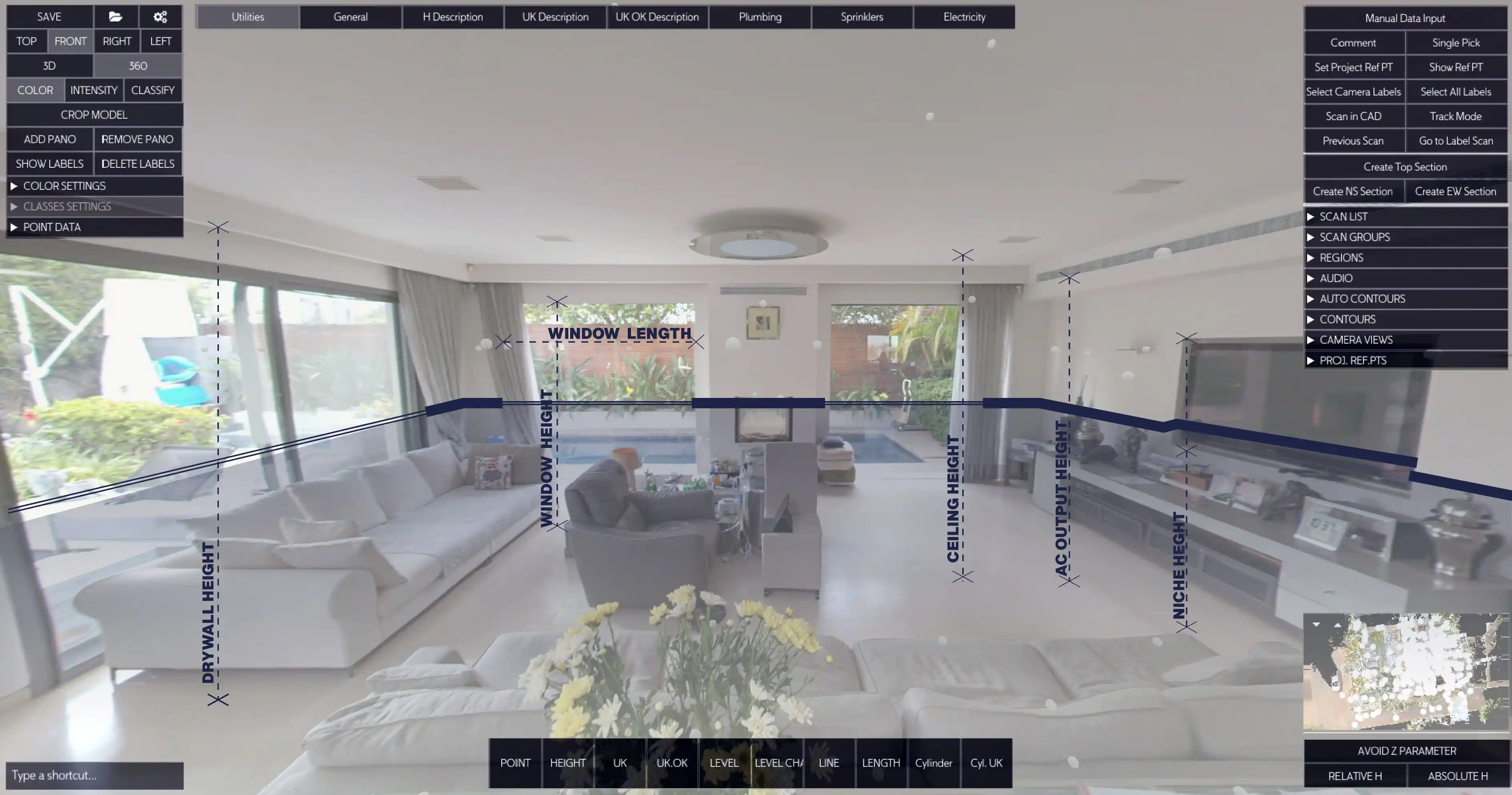
• Intuitive Panorama Workspace: Users can navigate a 360° panoramic view of the site to place blocks, text, and features accurately. This visual approach helps architects and surveyors create CAD drawings.
Benefits for Drafting and Surveyors
Nest3D’s AI-powered point cloud processing streamlines tasks across surveying projects:
• Architectural Drafting: Rapidly convert point cloud data into CAD drawings, minimising human error and saving significant drafting time.
• Surveying and Topography: Accurate DWG outputs support field-to-office workflows, enabling surveyors to produce detailed CAD drawings faster.
• Retrofit and Renovation Projects: Convert as-built point cloud scans into precise CAD drawings for renovations, extensions, or historical preservation projects. Accurate linework ensures proper planning and reduces on-site errors.
• Collaboration Across Teams: Standardised DWG linework allows multiple surveyors to work on a single project seamlessly, reducing discrepancies and rework.
Key Features of Nest3D Point Cloud Software
Designed for surveyors and CAD technicians, Nest3D Point Cloud Software brings speed, accuracy, and automation together to transform raw scan data into ready-to-use models. • Cross-Platform CAD Compatibility: Nest3D integrates with AutoCAD, BricsCAD, and ZWCAD, ensuring linework flows directly into familiar environments while maintaining existing layers, blocks, and linetypes.• One-Click Extraction: AI-powered extraction enables surveyors and experts to convert point clouds into DWG drawings rapidly.• 360° Visual Workspace: A fully interactive panoramic workspace allows precise placement of features, blocks, and annotations, ensuring drawings match real-world conditions.• Automation and Drafting Consistency: Standardised templates and automated workflows reduce human error and maintain consistent CAD outputs, streamlining collaboration across multiple users or teams.• Comprehensive SLAM Scanner Support: Supports terrestrial and mobile SLAM scans, allowing professionals to work with mono, intensity, or full-colour point clouds, adapting to various surveying projects.
Proven Results in Drafting and Surveying
Surveyors and experts worldwide rely on Nest3D to accelerate point cloud drafting and improve drawing accuracy:
• 60%-100% Reduction in Drafting Time: Automating linework extraction allows teams to complete more projects faster.• 50%-90% Reduction in Manual Effort: Less repetitive work frees professionals to focus on analysis and design.• 99.9%+ Accuracy: DWG linework is precise, production-ready, and template-driven.• Enhanced Team Collaboration: Processed data can be shared seamlessly across multiple users, improving project coordination.
These results highlight Nest3D as more than just a software tool, but as a workflow revolution for modern surveying projects.
Why Do Drafters and Surveyors Trust Nest3D?
Created by experts for surveying workflows, Nest3D balances usability and technical precision. Its intuitive interface, seamless CAD integration, and AI-driven linework extraction have earned widespread acclaim among professionals who need reliable, accurate, and rapid CAD outputs.
The Future Of Point Cloud AI
As surveying projects grow more complex, the need for reliable point cloud AI solutions is undeniable. Nest3D delivers a comprehensive platform for point cloud processing, enabling professionals to rapidly convert point clouds into DWG-ready CAD drawings with minimal effort.
Frequently Asked Questions:
- 1. Can Point Cloud AI handle large and complex scan datasets?
Yes. Modern Point Cloud AI tools are designed to efficiently process millions of points, optimize performance, and maintain smooth workflows even with heavy, high-resolution scans.
- 2. What surveying tasks can be automated using Point Cloud AI?
AI can automate wall extraction, floor segmentation, feature recognition, clash detection, measurements, mesh generation, and 2D/3D drafting support, significantly reducing manual workload
- 3. What types of projects benefit most from Point Cloud AI?
Projects such as renovations, infrastructure surveys, industrial plants, heritage restoration, and large-scale construction benefit greatly due to faster modelling and more reliable as-built data.
- 4. Can AI detect structural or MEP elements from point clouds?
Advanced systems can identify walls, floors, beams, pipes, ducts, and other elements—making it easier to convert raw scans into surveying-ready deliverables.
- 5. Do I need specialised hardware to use Point Cloud AI?
Most platforms run efficiently on standard surveying workstations, and many also offer cloud-based processing, removing the need for heavy local computing power.
.svg)


.svg)
