

Introduction
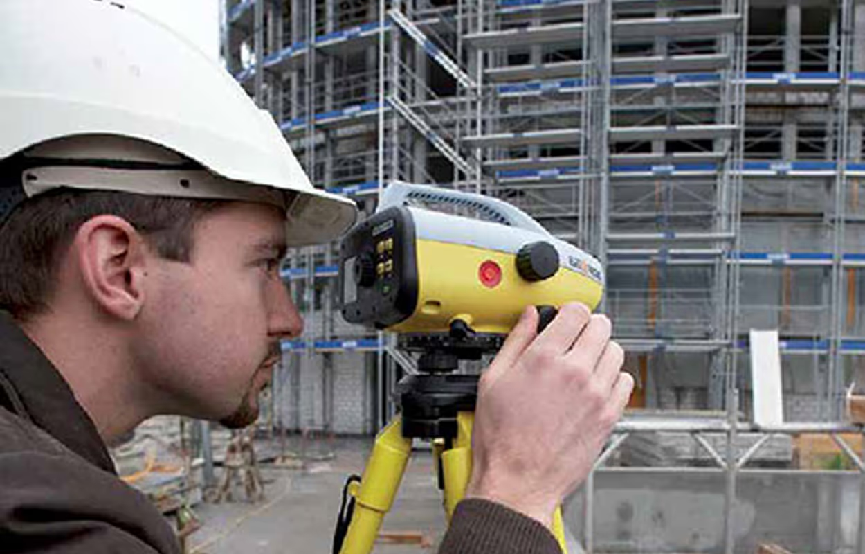
Turning raw scan data into usable drawings is one of the hardest parts of modern surveying. A laser scanner can capture millions of points in minutes, but converting that information into clear CAD drawings often takes days of manual work or expensive outsourcing. For many survey teams, this step is the bottleneck that determines whether a project runs smoothly or stalls.
The scan to CAD workflow is how surveyors transform point clouds into accurate, standardized DWG deliverables that architects, engineers, and contractors can actually use. In this guide, we will explain what the workflow looks like, the challenges of traditional methods, how automation changes the process, and the best practices that help you deliver reliable results. By the end, you will see why mastering this workflow is essential for faster, more profitable projects.
What Is a Scan to CAD Workflow?
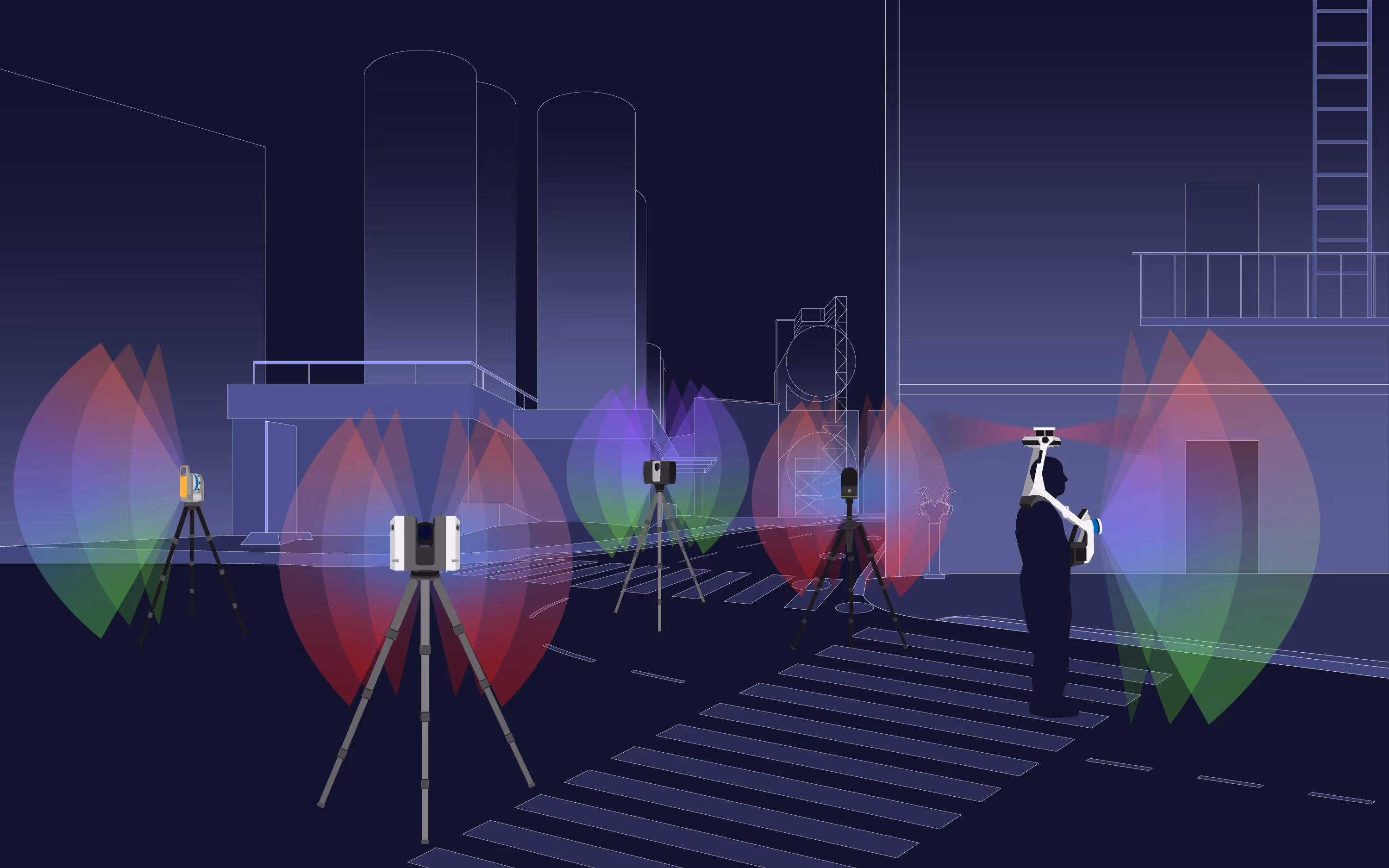
A scan to CAD workflow is the process of converting raw point cloud data into usable CAD drawings. Point clouds are created by 3D laser scanners that capture millions of points representing the surfaces of a building, site, or object. These datasets are incredibly detailed, but they are not deliverables that architects, engineers, or contractors can use directly.
Most projects require CAD drawings in DWG format because they are editable, standardized, and easy to integrate into existing design and construction workflows. Floor plans, elevations, and sections are all common outputs that clients expect as part of the survey deliverables.
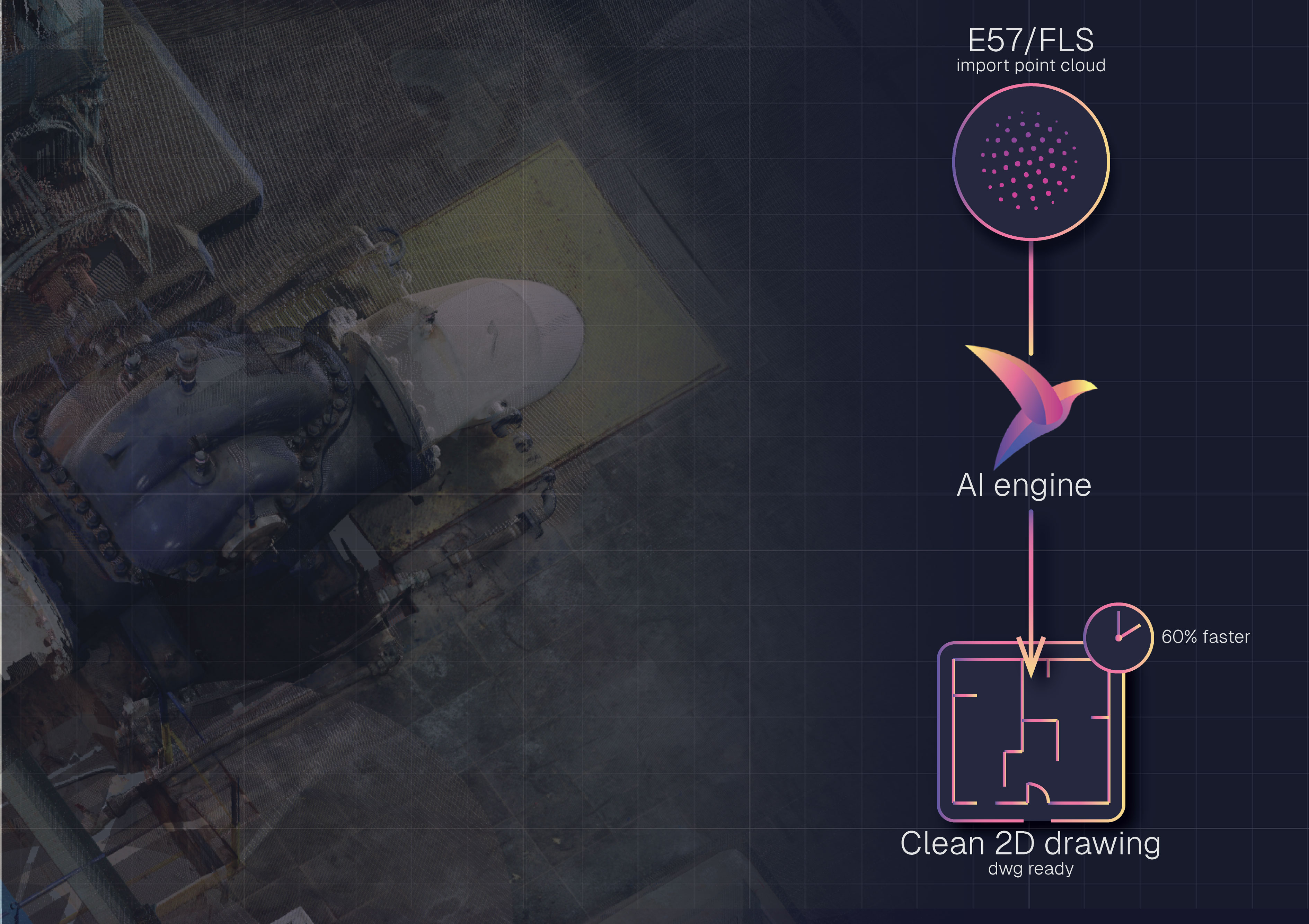
The scan to CAD workflow bridges the gap between raw data and these finished drawings. It allows surveyors to take formats like E57 or FLS, align them with company CAD templates, and produce linework that meets professional standards.
For a complete overview of why this process matters, see our Point Cloud to CAD guide.
Traditional Scan to CAD Workflow
For many years, surveyors have relied on manual methods or outsourcing to turn point clouds into CAD drawings. Both approaches can work, but they introduce serious bottlenecks in time, cost, and accuracy.
Manual Conversion
In a manual workflow, point clouds are loaded into a CAD environment and redrawn line by line. Surveyors trace walls, openings, and measurements directly from scan slices or sections. While this method gives full control, it comes with major drawbacks:
- Extremely slow: A single project can take 30–40 hours of tracing.
- Inconsistent accuracy: Human interpretation often misses small but critical details.
- High labor costs: Senior staff spend valuable time on repetitive drafting instead of project leadership.
- Limited scalability: Larger datasets overwhelm staff capacity, causing delays.
Outsourcing
Some firms outsource scan to CAD work to external drafting providers. This frees up internal staff but introduces new risks:
- Variable quality: Deliverables may not follow company CAD standards.
- Delays and revisions: Back-and-forth corrections can extend deadlines.
- High costs: Fees add up quickly, reducing project profitability.
- Loss of control: Surveyors have limited oversight of accuracy and detail.
Both manual tracing and outsourcing can deliver CAD drawings, but they struggle to keep up with modern project demands. When deadlines are tight and accuracy is critical, these traditional workflows often fall short.
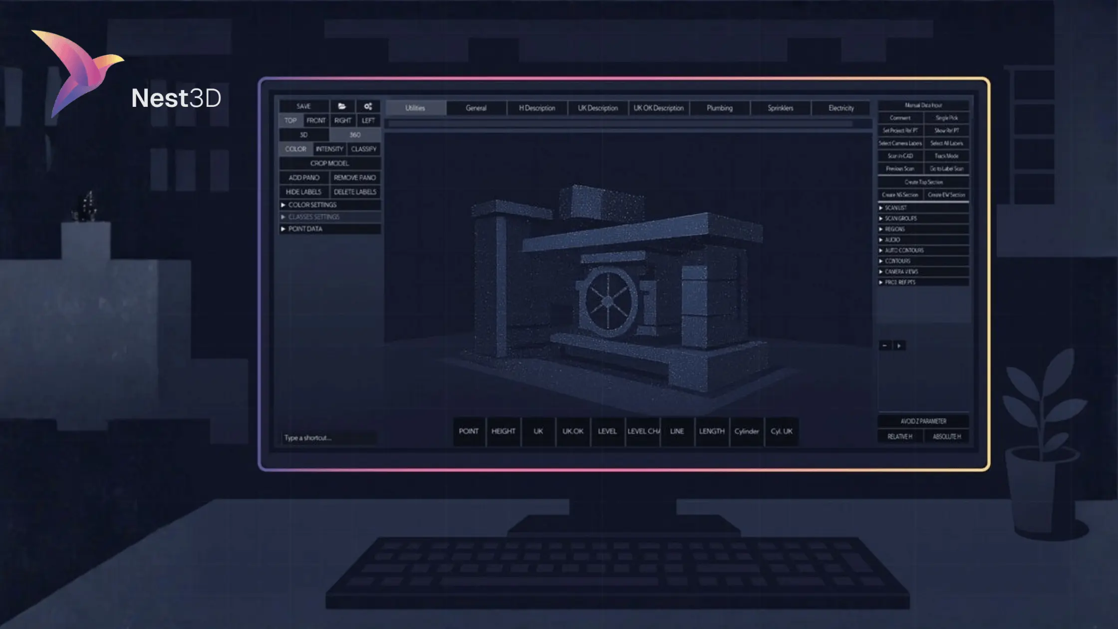
Automated Scan to CAD Workflow
The biggest change in recent years is the rise of AI-powered scan to CAD software. Instead of spending days tracing scans or relying on inconsistent outsourcing, surveyors can now complete the workflow in a fraction of the time with far greater accuracy.
These solutions integrate directly with AutoCAD, BricsCAD, and ZWCAD, applying company templates and generating linework automatically. By eliminating repetitive drafting tasks, AI allows teams to focus on quality control and project outcomes rather than redrawing what the scanner has already captured.
A modern automated workflow looks like this:
- Load scans in E57 or FLS format into the software.
- Apply a DWG template to ensure layers, linetypes, and blocks follow company standards.
- Pick features visually in a 360° workspace such as walls, doors, and heights.
- Stream linework directly into CAD in real time, driven by AI.
- Run QA with senior staff before final delivery.
Survey teams using AI report up to 60% faster drafting times and 50% lower outsourcing costs. The workflow also makes scaling easier, since junior staff can handle production while senior staff focus on verification and strategy.
For surveyors under pressure to deliver projects faster and more accurately, automation and AI have become the new standard for scan to CAD.
Best Practices for Scan to CAD
Getting reliable CAD drawings from point clouds doesn’t need to be complicated. A few simple practices make the workflow faster, smoother, and more accurate.
1. Use Standard DWG Templates
Starting with clean templates ensures layers, linetypes, and blocks are consistent across every project.
2. Split Large Scans Into Sections
Breaking scans into zones like floors or site areas keeps software running smoothly and drawings easier to manage.
3. Keep Full Precision
Work with the highest scan detail available. This avoids mistakes and keeps measurements accurate.
4. Build a Repeatable Process
Document how scans are imported, drafted, and reviewed. A simple checklist saves time and helps new team members get up to speed quickly.
By keeping the workflow simple and repeatable, survey teams can deliver faster results with fewer errors, without adding complexity to their day-to-day work.
Benefits of Automating Scan to CAD
Survey teams that switch from manual tracing or outsourcing to automation see immediate improvements. The gains are clear across speed, cost, and accuracy.
1. Save Time
Automation reduces drafting time by up to 60 percent, turning what used to take days into a few hours.
2. Cut Costs
Less manual labor and fewer outsourcing needs mean project costs drop by nearly half.
3. Improve Accuracy
AI-driven linework matches the scan directly, producing consistent and precise drawings every time.
4. Scale Projects Easily
With repetitive work handled automatically, teams can take on more projects without adding extra staff.
5. Deliver More Value
Clients receive faster, higher-quality drawings, which strengthens trust and leads to repeat business.
Automation transforms scan to CAD from a bottleneck into a competitive advantage.
Why Choose Nest3D
Nest3D isn’t just another point cloud tool — it’s purpose-built to take you from raw scans to finished CAD drawings faster and more accurately than ever before.
Key Features That Make the Difference
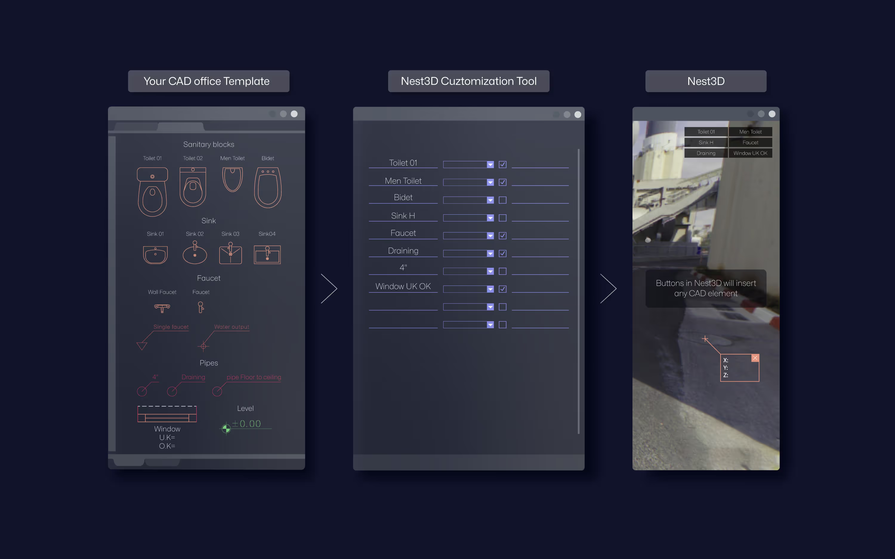
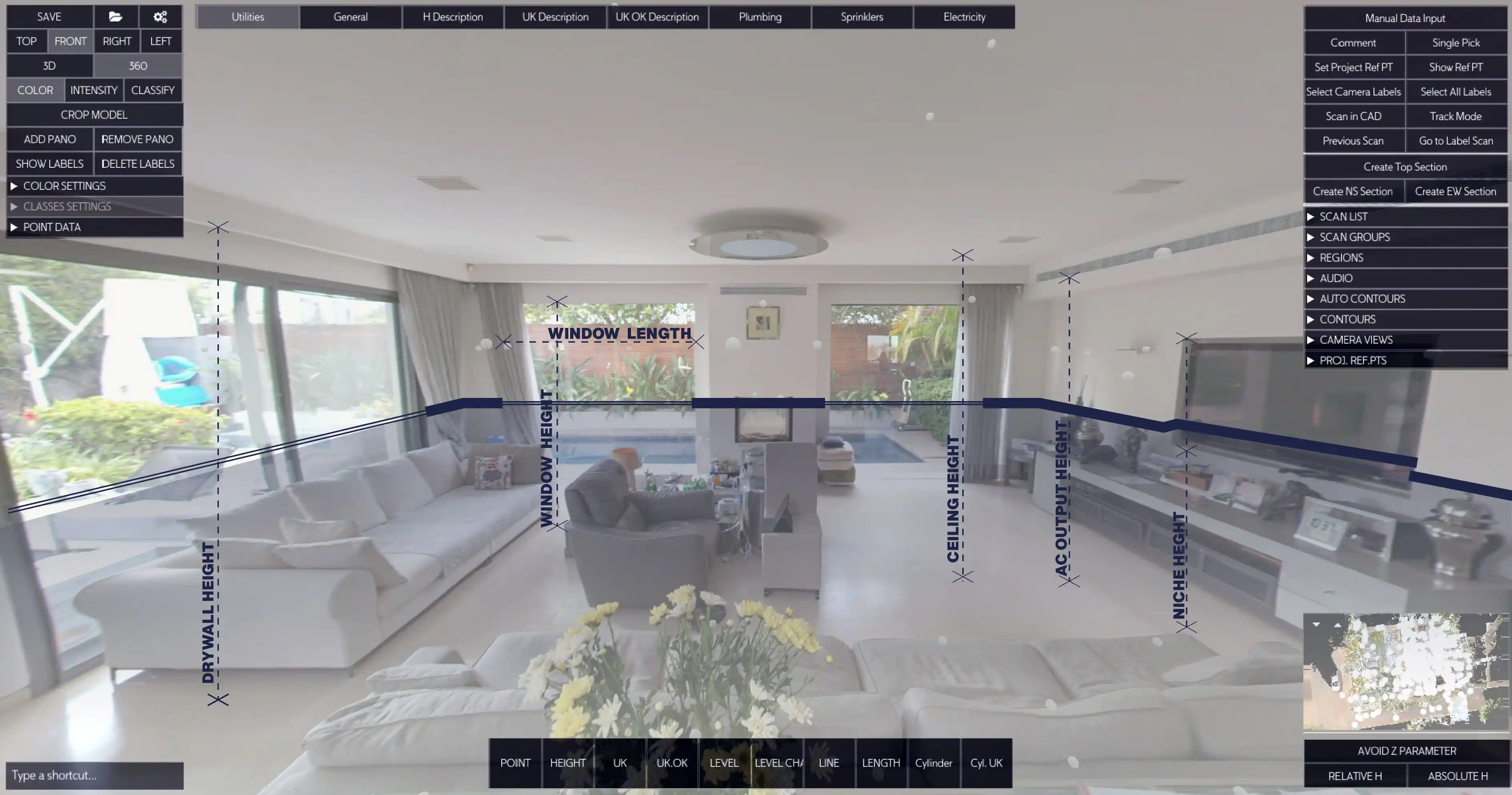
One-Click Wall Extraction
Generate clean, accurate linework instantly from the panorama view.
Accurate Drawings
Every output follows your templates, layers, and blocks, ensuring CAD standards are never broken.
Work in a 360° Image Workspace
Navigate visually, pick features, and place elements with confidence.
Seamless CAD Connectivity
Insert blocks and text directly from your DWG standard without manual rework.
60% Faster Than Manual Tracing
Deliver drawings up to 60% faster and cut outsourcing costs in half.
Reliability You Can Trust
Every project stays consistent, so deliverables are always dependable.
Flexible Color Support
Switch between mono, intensity, or color imagery for clearer interpretation.
Effortless Topography Mapping
Build detailed topo maps from geo-referenced scans directly inside CAD.
SLAM Support
Use terrestrial or mobile SLAM scanners in the field and draft from them in the office.
Dynamic Buttons
Create your own toolbar shortcuts to place blocks or text based on measured elements.
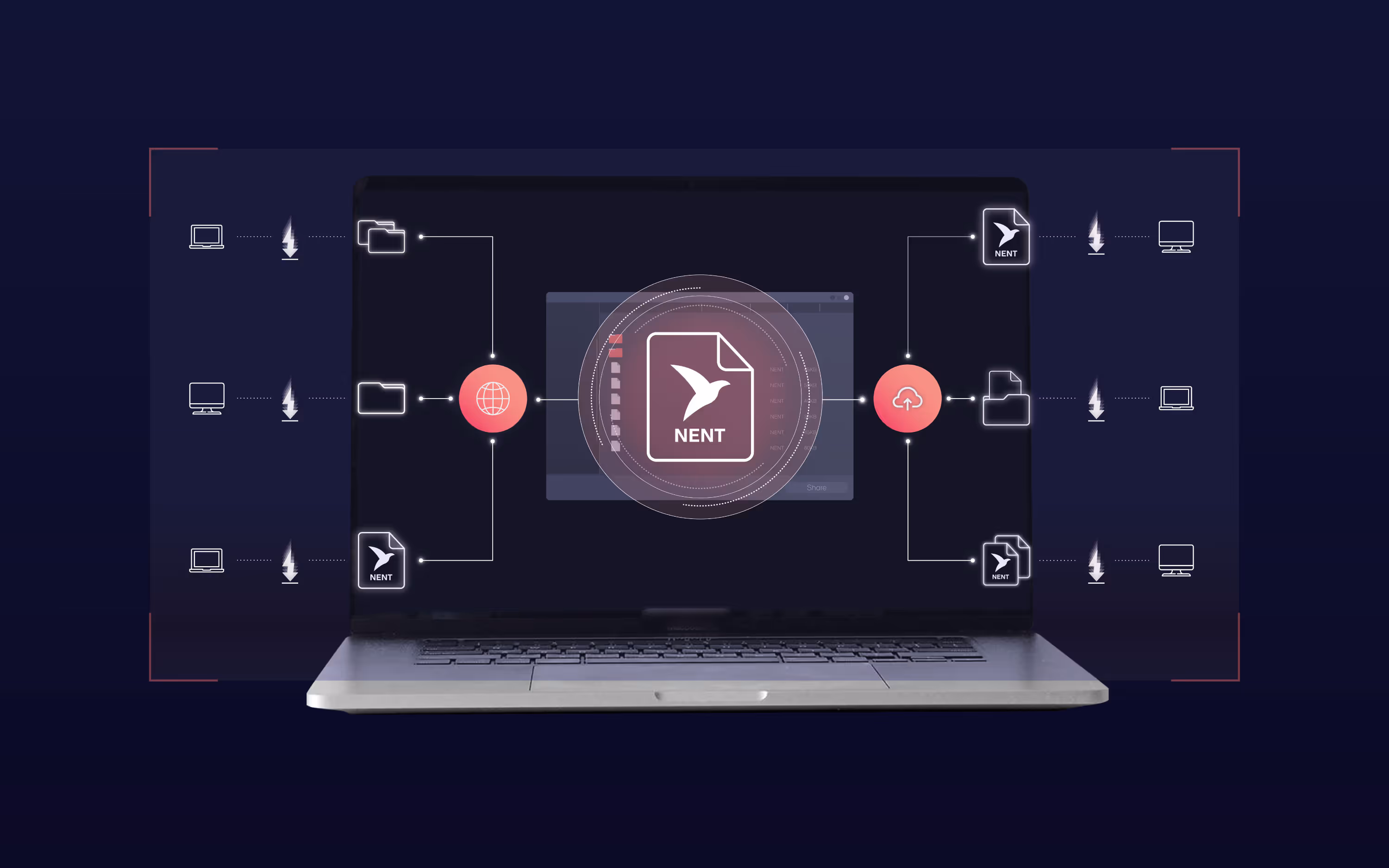
Team Collaboration
Share lightweight data formats across machines for large or distributed projects.
From field capture to finished CAD drawings, Nest3D delivers a complete end-to-end workflow that surveyors worldwide already trust.
Conclusion
The scan to CAD workflow is where projects either stall or move forward with speed and accuracy. Manual tracing wastes valuable time, and outsourcing adds cost and risk. Automation changes the equation by turning raw scans into usable CAD drawings in a fraction of the time.
With the right software, survey teams can:
- Deliver projects 60% faster
- Cut outsourcing costs by half
- Maintain accuracy and CAD standards across every drawing
Nest3D makes this possible inside the CAD platforms you already use. By combining automation with precision, it gives surveyors a reliable way to meet deadlines, control costs, and build client trust.
Explore today and experience faster, more accurate scan to CAD workflows.
Turn Point Clouds into CAD in Seconds
Cut drafting time by 60 percent and deliver accurate DWG drawings without manual tracing. Try Nest3D free for 14 days with no credit card required.
Get Started for Free
.svg)


.svg)
