

.svg)
.avif)
.avif)
LESS CLICKING, MORE CREATING
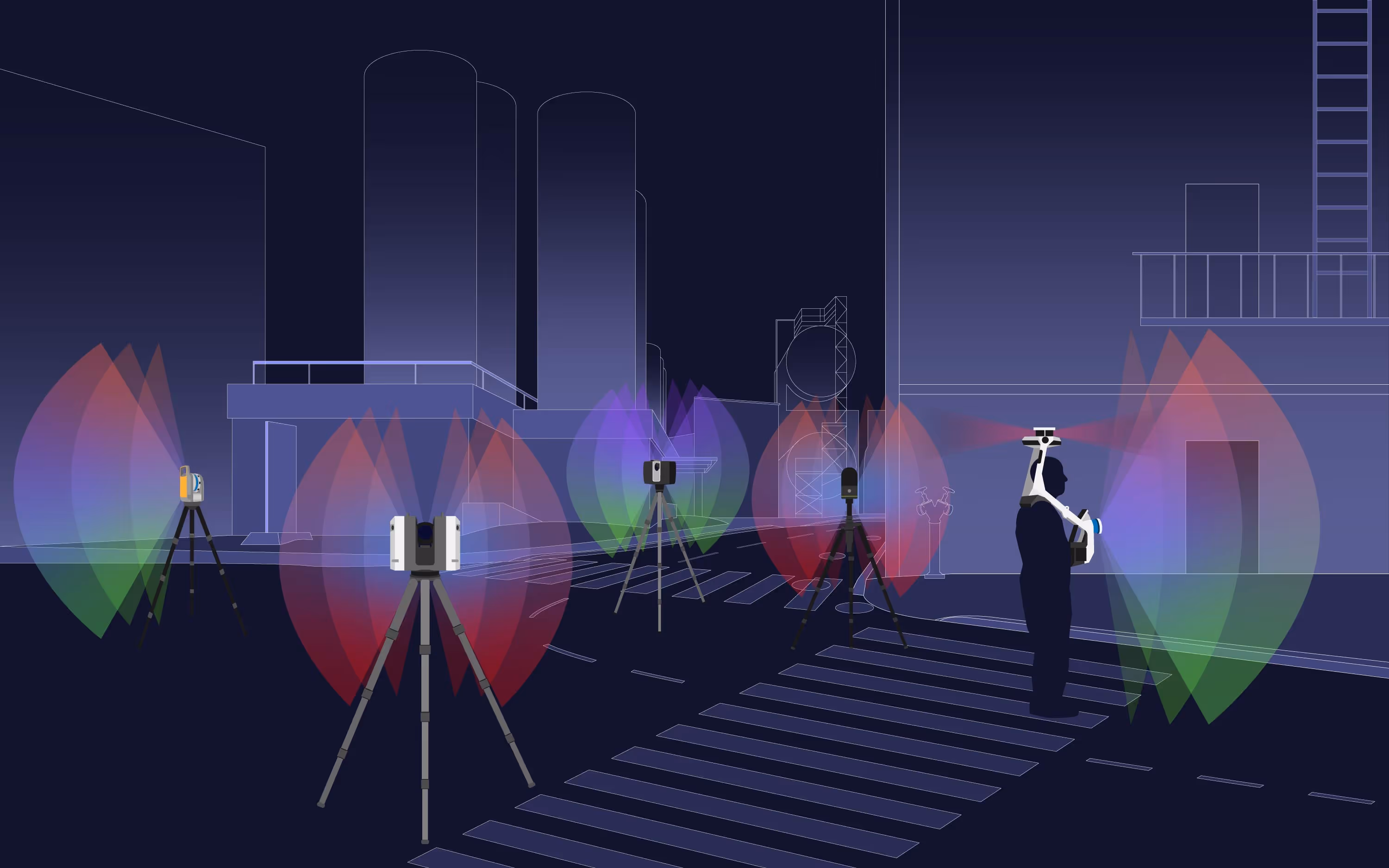
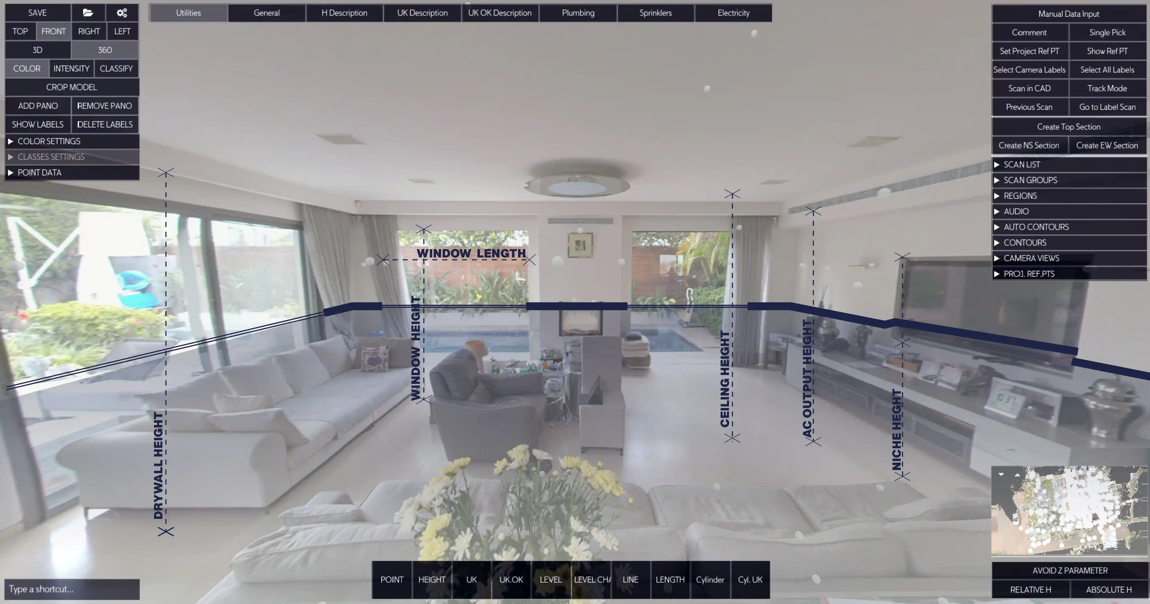
Work in the 360º LIDAR-backed image
Rapidly convert point cloud data intoprecise CAD drawings with less effort andtime.
.svg)
Flexible, Easy-to-Use
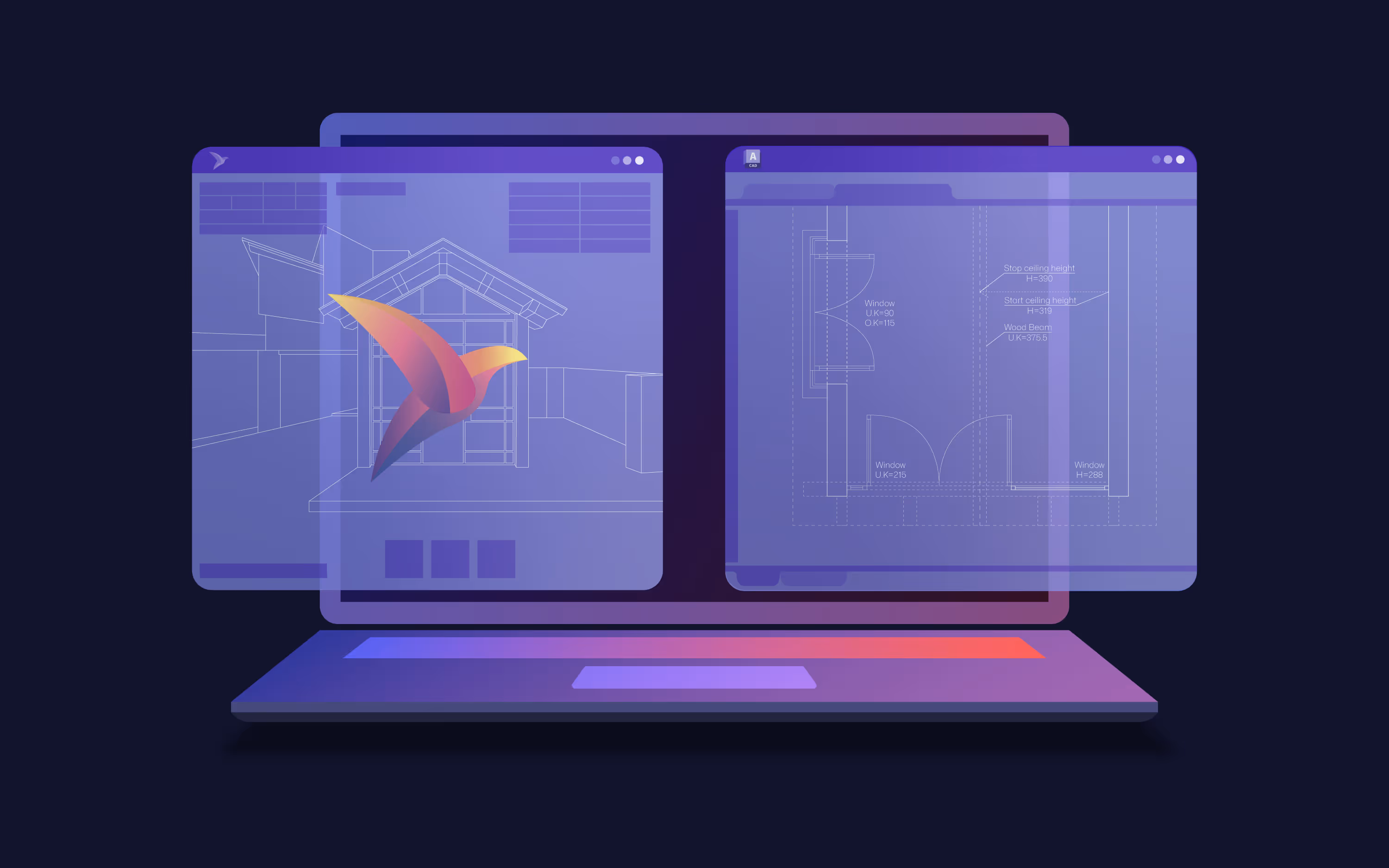
Seamless CAD Tool Integration
Pairs with AutoCAD, BricsCAD, ZWCAD
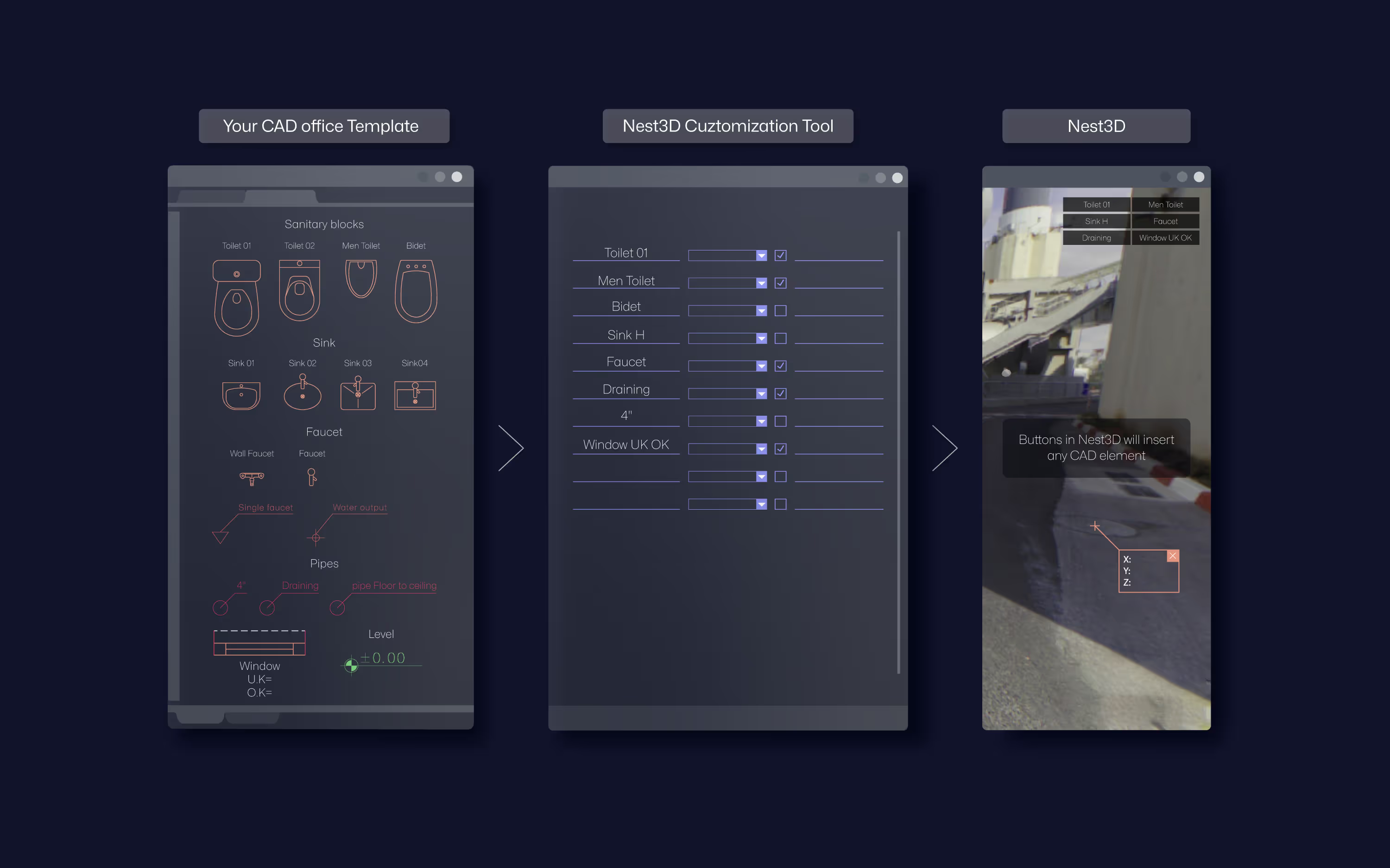
Fully Customizable
Free Setup, Training & Support
Rapidly convert point cloud models into precise CAD drawings with less effort
Compatible with Major CAD Platforms


Point Clouds, Perfected
Extract elements directly from the panorama and generate clean DWG linework inside your CAD already formatted to your standards
.svg)
Manual tracing
.svg)
Instant linework
Clean, accurate drawings


.avif)


.svg)
.avif)

.avif)
.avif)
.avif)
.svg)


.svg)
